


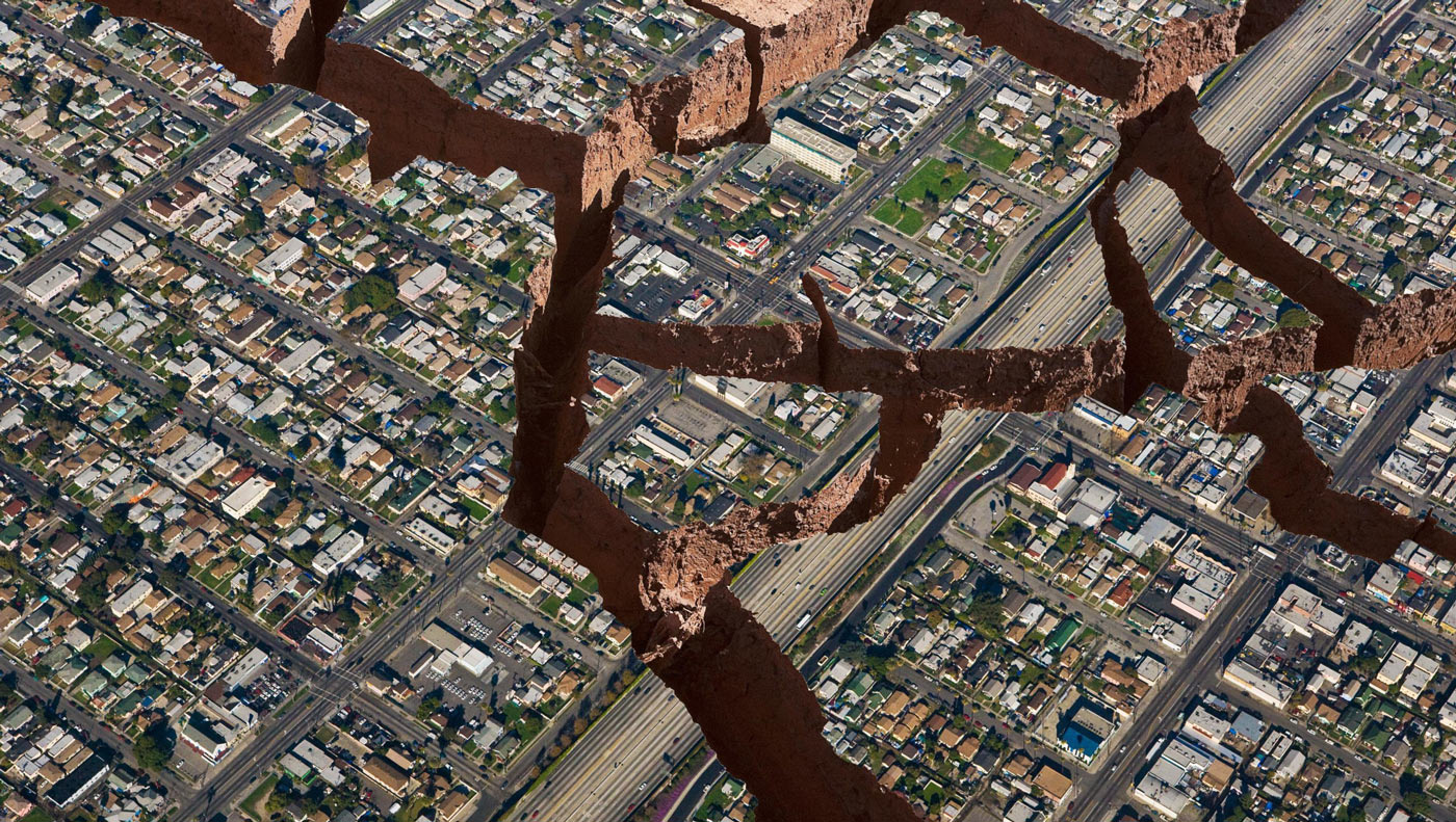
Disaster mapping, also known as crisis mapping, is a method used to evaluate, record, and communicate data regarding the location of a disastrous event as well as the distribution of its effects or potential effects. Disasters might be abrupt, but it is possible to foresee their impact on regions, therefore, the damage magnitudes and affected people. Every year, we encounter disasters and their consequences, such as earthquakes, floods, and tsunamis in various parts of the world. In order to gather information regarding the damages caused by these disasters to a particular area or population, as well as probable damages or impacts likely to occur, it is necessary to assess the frequency, severity, area/region in which they occur, and impact. Therefore, the use of mapping is helpful not only in pre-disaster preparedness but also in rescue and relief operations. Geographical information system (GIS) is one of the modern, specialized approaches that are useful for disaster mapping too. These techniques have proven to be very helpful as data/information collection, storage, and retrieval become more sophisticated and scientific.
GIS has progressed from an idea to a science in the last five decades. A geographic information system (GIS) is a data creation, management, analysis, and mapping system for various kinds of information. GIS links information to a map by fusing location data with various kinds of descriptive information. This offers a basis for research and mapping that is utilized in nearly all fields of study and business. Users can better grasp linkages, patterns, and geographic context with the aid of GIS. Better management and decision-making, as well as increased efficiency and communication, are among the advantages. Basically it is a spatial system that creates, manages, analyzes, and maps all types of data.
Some Key Roles of GIS in Disaster Management
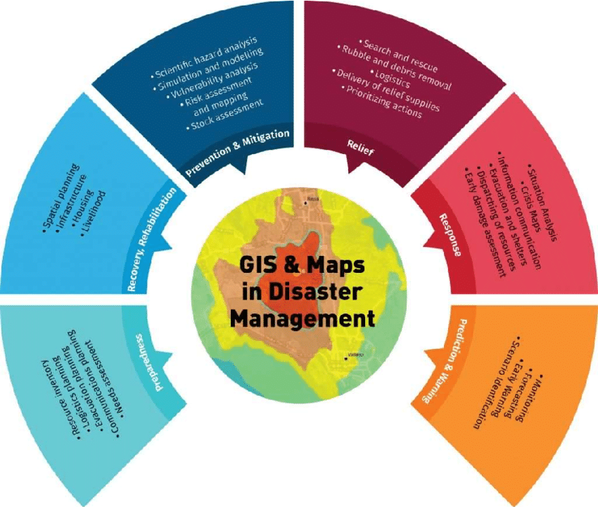
In the past, before the emergence of GIS, response decisions during disasters were primarily based on previous experiences and intuition rather than real-time information. However, in the contemporary context, access to real-time data on various parameters such as topography, geographic features, population, infrastructure, and demographics has become critical for effective response and recovery efforts. GIS can amalgamate data from diverse sources into a unified platform, making it easily accessible to a wide range of stakeholders involved in disaster management. This technology facilitates the swift dissemination of crucial information during emergency situations. Furthermore, the visualization of this data aids in the analysis of a given situation, enabling prompt decision-making.
In more developed nations around the world, GIS has been effectively harnessed to address all phases of disaster management, encompassing preparedness, mitigation, response, and recovery. The incorporation of GIS serves as a foundational element due to the interconnected nature of these stages. The results and insights obtained from one stage of disaster management are subsequently utilized as inputs for the succeeding stages, ensuring a well-coordinated and efficient approach.
GIS can be used to identify problems, monitor changes, manage and respond to events. Disaster management and response is one of the fields that GIS plays an important role. From risk assessment to situational awareness, from emergency response to recovery, where does GIS stand when it comes to disaster?
Risk Assessment and Planning
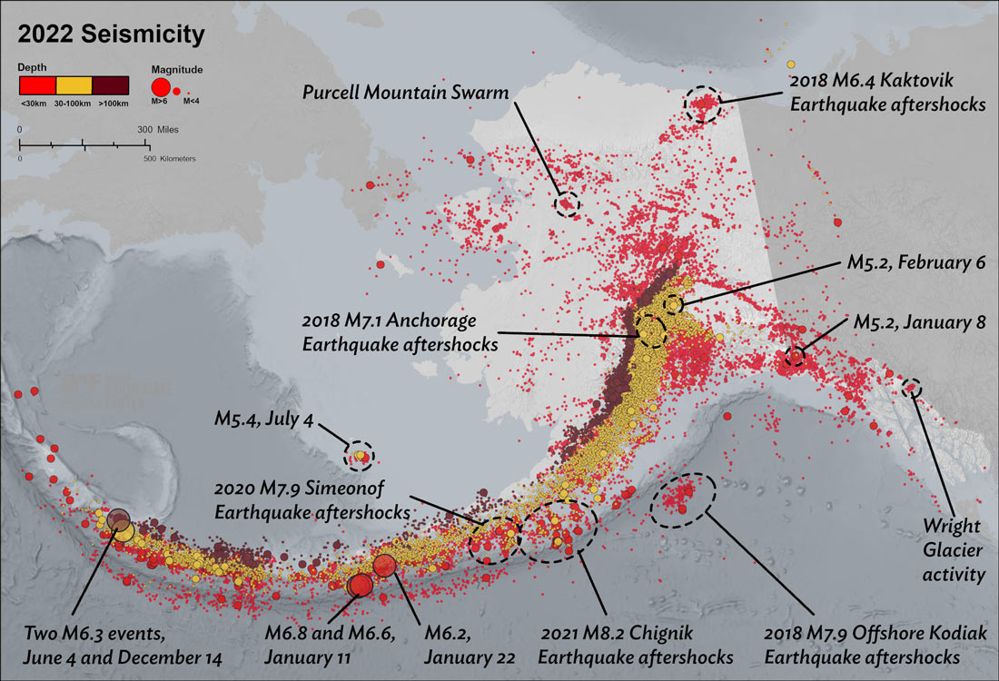
Tools for evaluating systemic risk and community vulnerability, creating efficient policies and risk-reduction plans, and involving the entire community are necessary for hazard mitigation. Through the integration of data related to terrain, infrastructure, population density, and past event patterns, GIS facilitates the identification of high-risk areas, vulnerability assessments, and the creation of efficient disaster management strategies. While helping where to focus, the data obtained can trigger changes in the policies for both built environment and social responsibilities. Enabled identification of vulnerable situations and infrastructures, such as buildings, roads, and critical facilities within the hazard-prone areas is essential for planning of the cities, building codes, designing resilient infrastructure or essential disaster responses for evacuation routes and resource allocations.
Preparedness is counted as one of the four pillars of disaster management, along with mitigation, response, and recovery. While it is possible to take precautions against disasters that may occur with the data obtained, it is also possible to plan the situations that need to be realized in case of encountering unavoidable conditions. Questions such as how many people live in the vulnerable region and how many of them are at risk, where are the buildings and infrastructure located and what are the current resilience conditions of them, under unavoidable hazards, when is the best time to evacuate, where are the safe structures that could be used as shelters? Answers to these questions create awareness and efforts to be prepared for such situations. GIS in this case, helps to answer these questions and create a database for beneficial planning.
Emergency Response and Situational Awareness
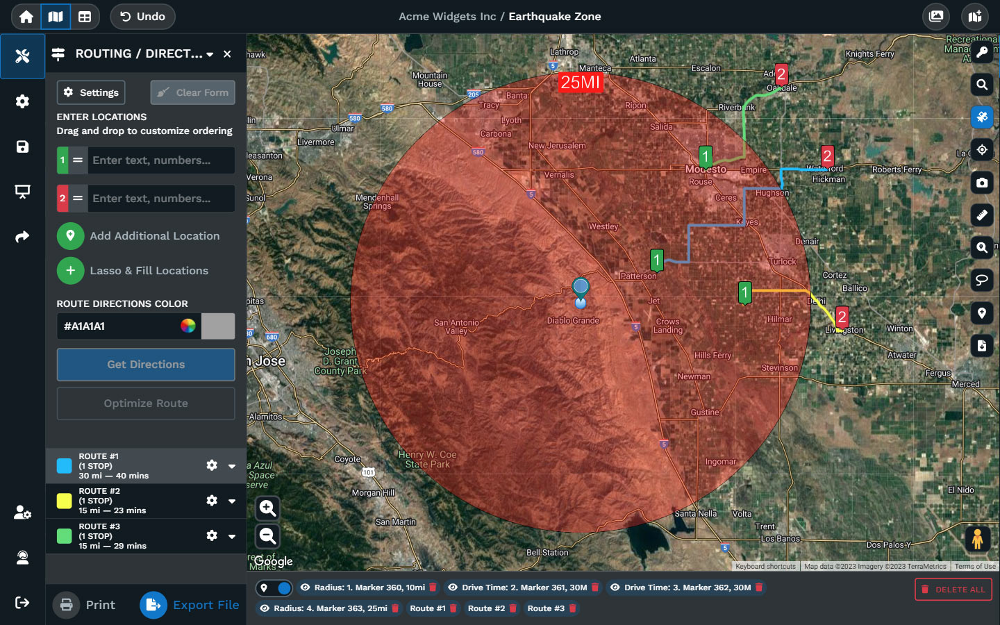
During disasters, it is critical for response efforts to create and maintain situational awareness. Collecting and sharing data manually is a slow method, where the obtained data can easily become out-of-date. GIS in this case, can help to provide mapping and analytics that allow to obtain what is happening in real time with brief descriptions that can create immediate responses. The system can enable emergency response teams to quickly intervene with real-time data from various sources, such as satellite imagery, weather data, social media feeds, and sensor networks. Affected areas can be identified, population density can be estimated, evacuation routes can be found, and response efforts can be coordinated with the use of this information in situation maps.
The enabling of real-time situation awareness also creates effective communication and coordination between emergency response teams. The sharing of geospatial information maps allow the creation of evacuation plans and resource locations. This mapping helps in coordinating logistics, optimizing resource distribution, and minimizing response time. With the use of GIS, many agencies and reaction teams may work together, share information, and make responsible assessments based on a shared operational picture.
Damage Assessment and Recovery
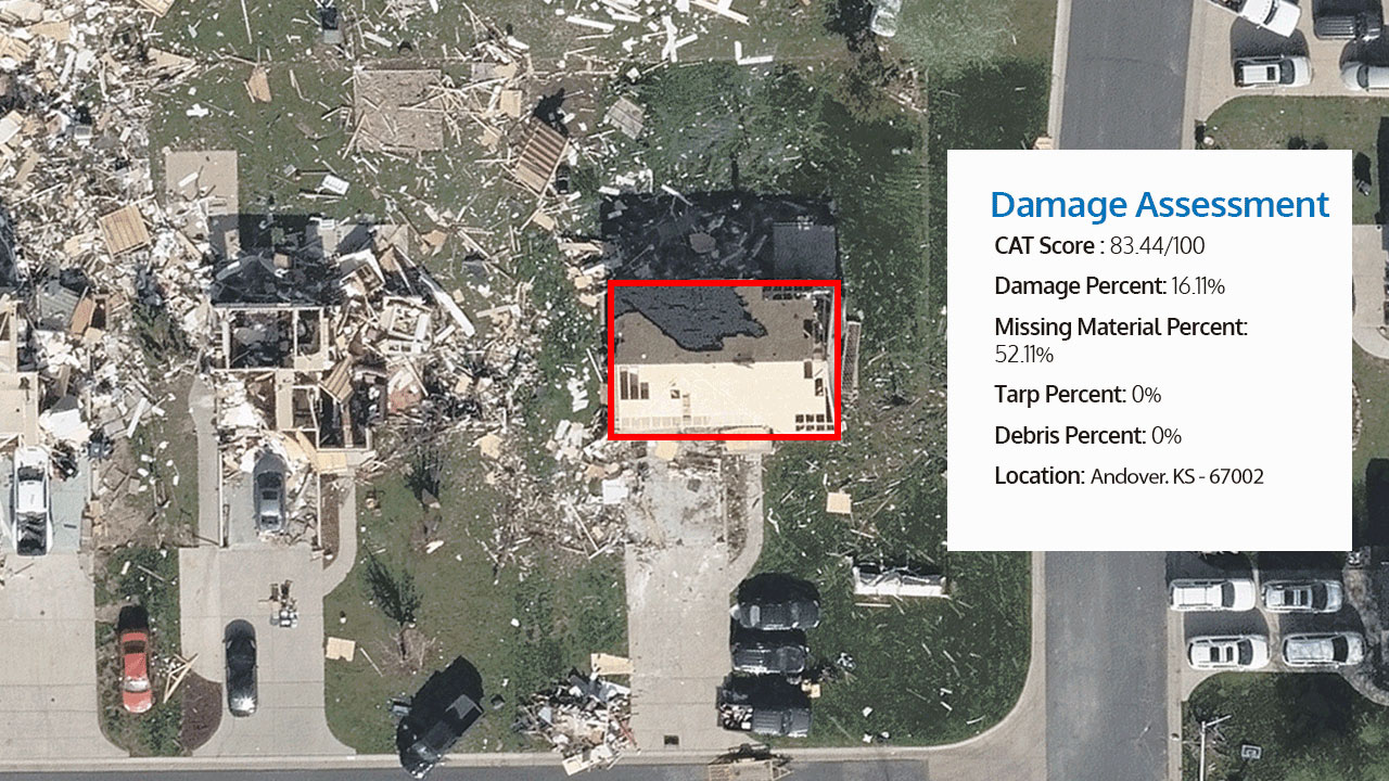
In the post-disaster period, it is important to understand the impact of the disaster and accurately deploy resources to achieve community recovery. Damage assessment plays a key role for the road to recovery. Damage assessment aids in calculating the number of homes damaged, families uprooted, short-term casualties and injuries, and damaged infrastructure. Additionally, it facilitates the restoration of communication so that it functions more effectively going forward or lays the groundwork for an emergency communication network that can come online right away in the event of a crisis.
Emergency response teams can determine regions of devastation, evaluate the extent of damage to infrastructure (buildings, roads, bridges), and prioritize rescue and recovery activities by comparing pre-disaster and post-disaster satellite pictures or aerial photography. Reconstruction planning and resource allocation can be aided by this information. In order to identify and measure the level of damage, GIS helps in post-disaster damage assessment by superimposing pre-disaster data with aerial or satellite photos. This data helps with estimating financial losses, allocating resources, and setting priorities for recovery operations. GIS can also make it easier to keep an eye on rebuilding initiatives and monitor the development of rehabilitation efforts.
The four pillars of disaster management can be counted as preparedness, mitigation, response, and recovery. The key roles of GIS mentioned above highlight its importance in each phase of disaster management. In summary, Geographic Information Systems play an important role as a helper in disaster management by providing essential data and geospatial tools that enable more effective disaster preparedness, response, and recovery. The roles of GIS are becoming more important with the increasing frequency and severity of disasters. The data-driven insights and geospatial capabilities can help to empower effective disaster management, ensure the safety and security of communities, and foster a more prepared, resilient future. Through functions like early warning systems, resource allocation, damage assessment, risk analysis, and public awareness, GIS contributes significantly to improving disaster management strategies and ultimately enhances the resilience of communities facing various disasters.
